


The biggest change in 2022 compared to the previous years was the installation of a GPS locator system in all boats participating in the competition. With this move the organisers aim to make the analyses of eventual violations unequivocal and accurately retraceable for everyone. This year also the both boats of all teams will have a GPS signalling device which will be fixed by the marshal with a numbered safety seal and only a marshal will be entitled to remove it. With the help of this device the competition committee will monitor the movement of the boats during the whole competition!
The device will send information to a closed system and will provide credible information, if the boat leaves the area designated for the teams. The rules define the maximum distance where the rigs can be put in and a violation of this rule will result in severe sanctions.
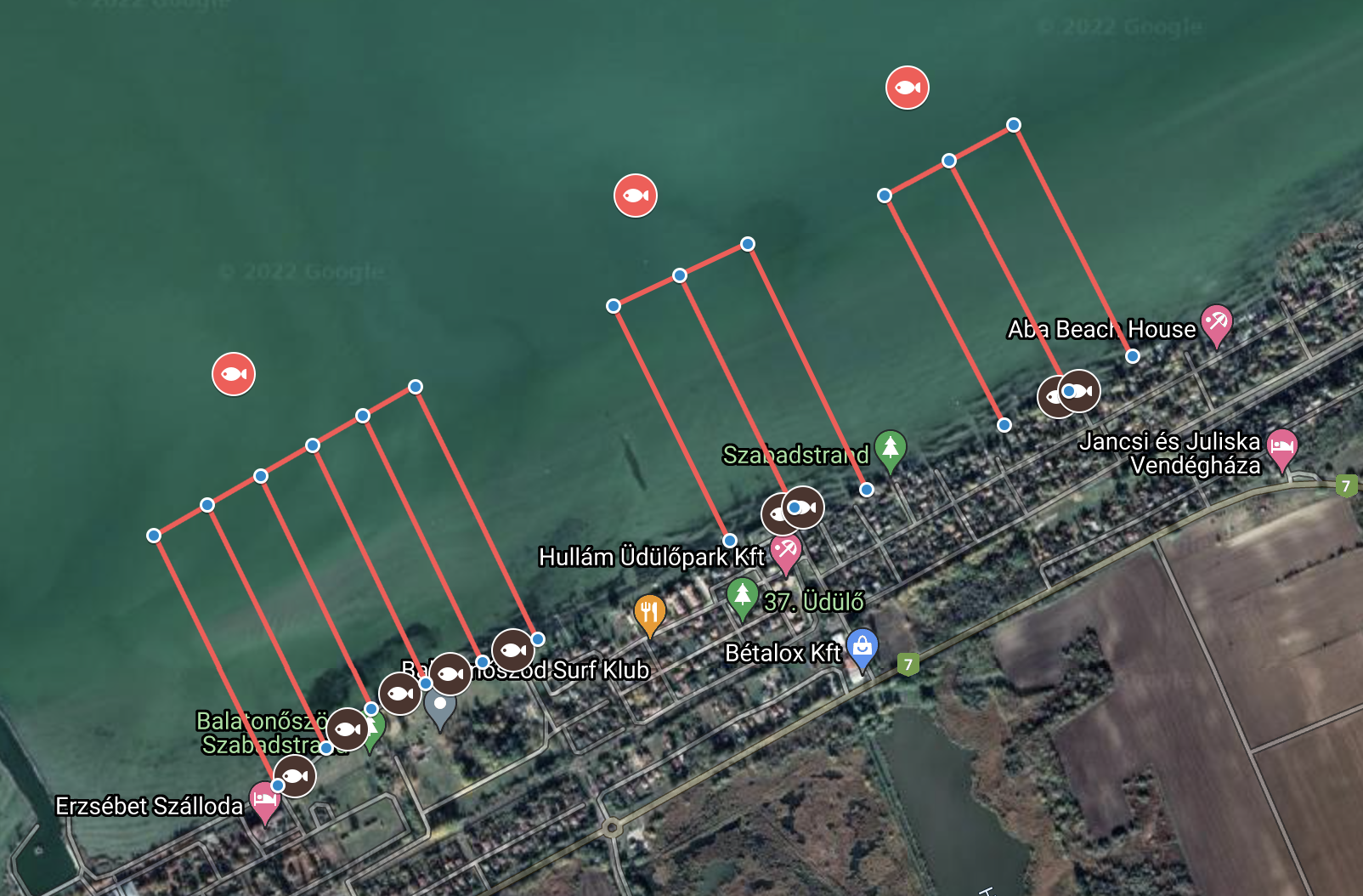
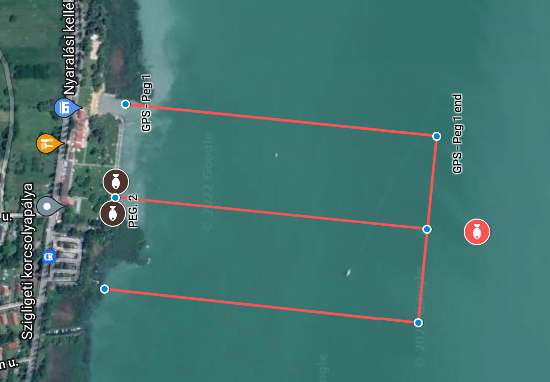
Let’s have a look at how the system works in reality:
There are 4 GPS coordinates to all pegs drawn, which are defined by the organizers of the competition after a preliminary recon of the venue, according to the local peculiarities. The most important characteristic of these coordinates is that the farthest points are at an equal distance from each other and the width of the fishable areas are also identical on similar spots depending on the given characteristics. The competitors receive the data of these virtual points before the start, and it is the task of the competitors to actually signalise these.
The teams have the possibility to physically signalise these coordinates in the preparatory phase, within 3 hours before the start of the competition. After this period the system will go live and the possible sector trespasses will mean sanctions! Based on the GPS coordinates received, different buoys can be placed which will help in the orientation on open areas. If there is a 2nd level storm warning, then it is obviously PROHIBITED to go on the water and the area can only be signalised afterwards.
A GPS receiver in the boat can be of help, because this shows the current position. The positions of the buoys set up this way are only indicatory! The Oni System sends an immediate, automatic notification to the head marshal of the competition, if the signaller leaves the area designated for the team and this way it can also be documented, whether the team was on the water during a 2nd level storm warning.
The GPS tracking devices will be handed out for a deposit of EUR 300 or 120.000 HUF paid at the registration on the spot, at the boat-check. The deposit can only be paid in cash and only in euros. This amount will be given back after returning these undamaged at the venue of the award ceremony. The devices will be mounted on the boats, at the boat-check, before the start of the competition on Sunday, directly at the peg, in the presence of the marshals with a safety seal.
IMPORTANT!
At the draw we will provide the GPS coordinates in the following format.
E.g.: 46.70831, 17.37319
The teams are responsible for setting up the corner points of the sector correctly and please take into consideration during the preparations in which GPS format the team’s GPS devices operate.
In this video we provide you with the basic information regarding the GPS system:
https://www.youtube.com/watch?v=657yVAulXR8
The competition rules set out the introduction of the GPS system en details.